Moosehead Lake Depth Maps
Angela Quintal-Snowman
- 22 maart 2022
- 9798869190482
Samenvatting:
See the depths of Moosehead Lake in Full Color!
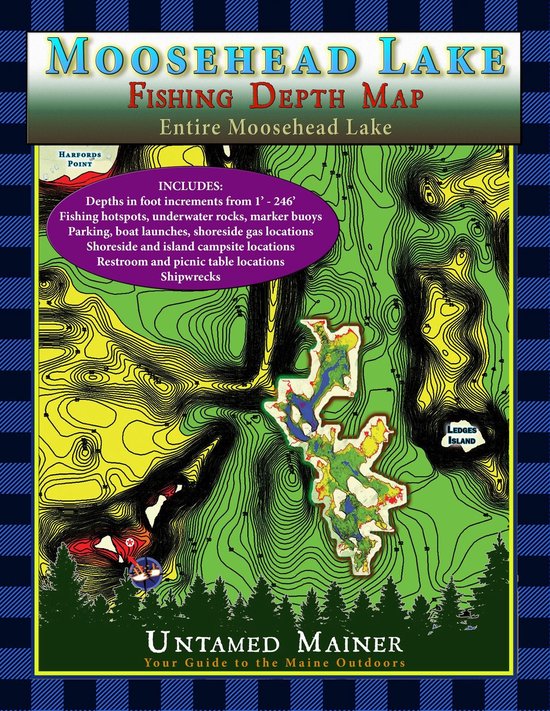
The Moosehead Lake depth maps are here! The Moosehead Lake Depth Map Atlases offer detailed 1-foot depth increments to show the contours of the bottom in full color, making it easy to find drop-offs, shallow areas, deep basins, and underwater mountains. The maps include the locations of underwater rock hazards, islands, fishing hotspots, parking, trailered & hand-carry boat launches, water-accessible fuel, picnic tables, restrooms, campsites, shipwrecks (in books 2 and 4), hazard buoys, channel buoys, no-wake zones, and the two-mile light buoy.
These maps are perfect if you love fishing, boating, canoeing, kayaking, camping, diving, & adventure on Moosehead Lake!
The maps include the locations of:
- Underwater rock hazards
- Fishing hotspots
- Parking
- Trailered & hand-carry boat launches
- Water-accessible fuel
- Picnic tables
- Restrooms
- Campsites
- Kineo Fire Tower
- Shipwrecks
- Hazard buoys
- Channel buoys
- No-wake zones
- Two-mile light